Below are examples of excellent work from students in my previous GIS classes.
Click on the thumbnail to see a larger image of the document or click on the title to see a PDF of the document.
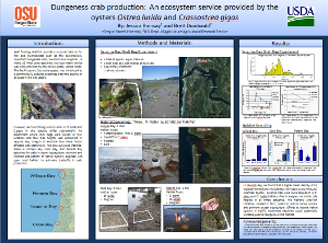 |
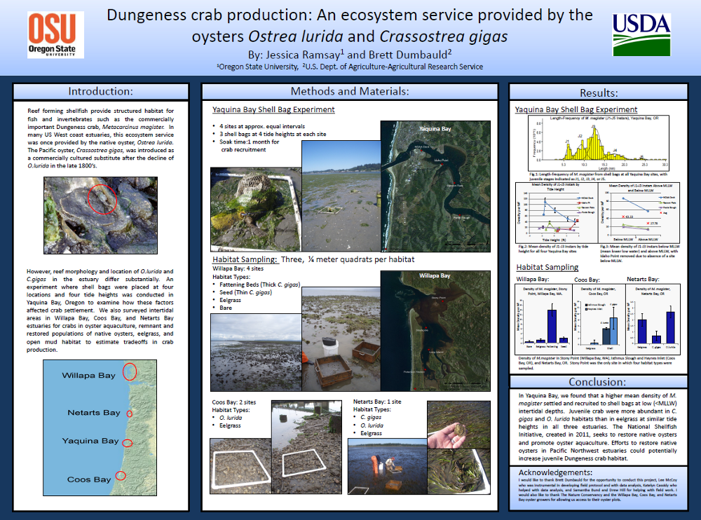
Dungeness crab production: An ecosystem service provided by the oysters Ostrea lurida and Crassostrea gigas
By Jessica Ramsay and Brett Dumbauld |
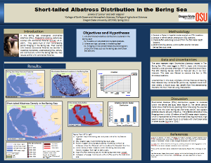 |
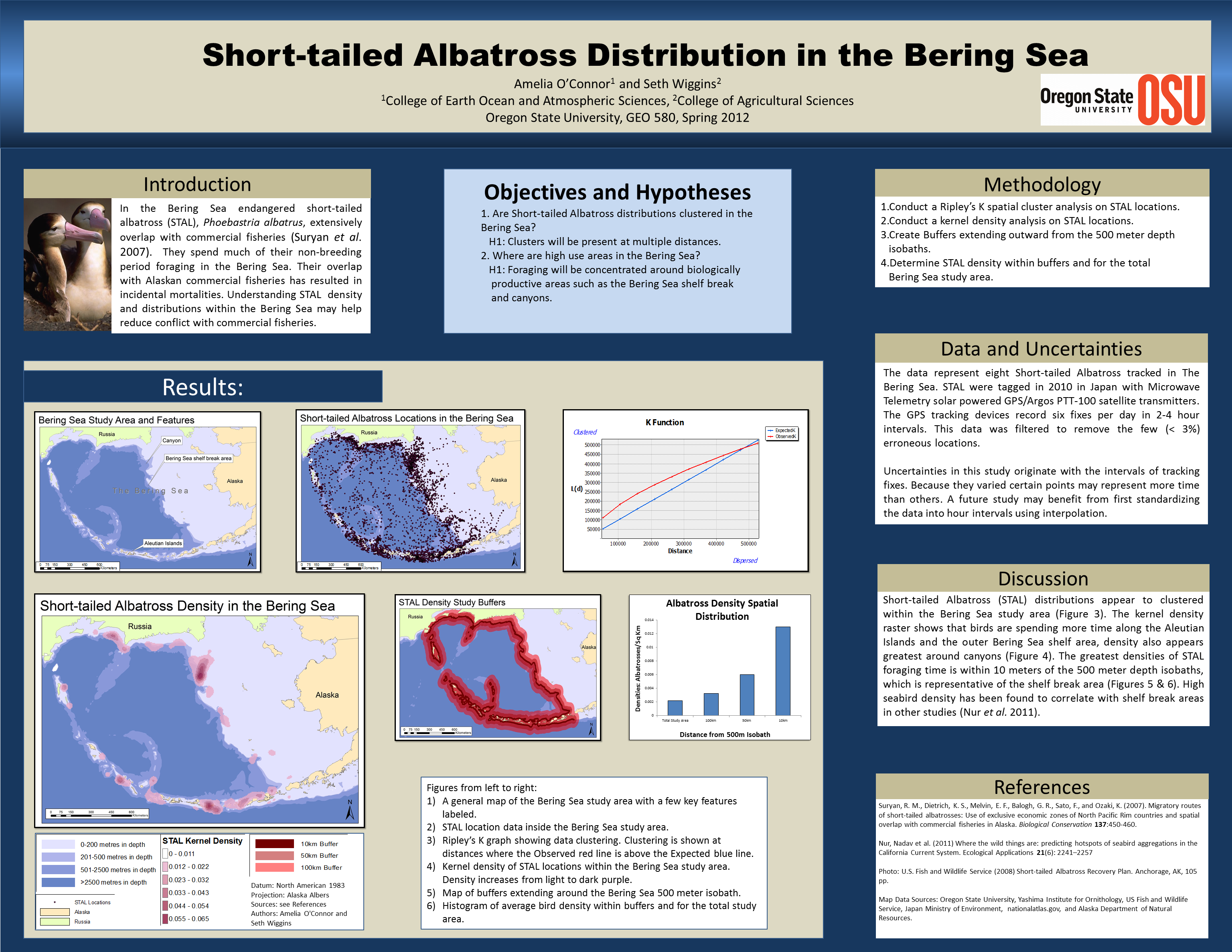
Short-tailed Albatross Distribution in the Bering Sea
By Amelia O’Connor and Seth Wiggins |
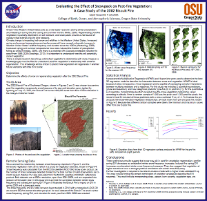 |
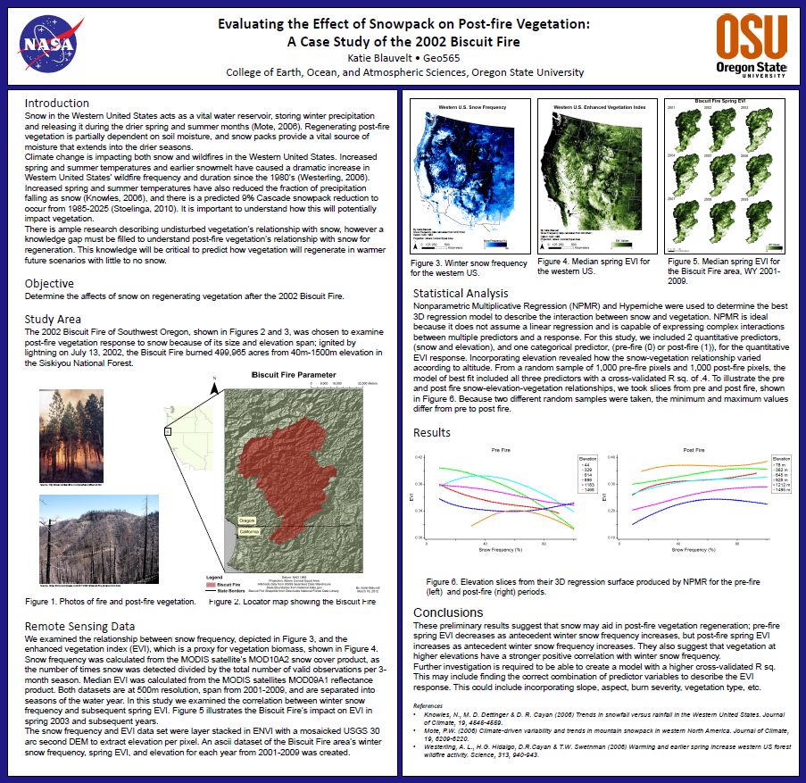
Evaluating the Effect of Snow pack on Post-fire Vegetation:
A Case Study of the 2002 Biscuit Fire
By Katie Blauvelt
|
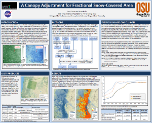 |
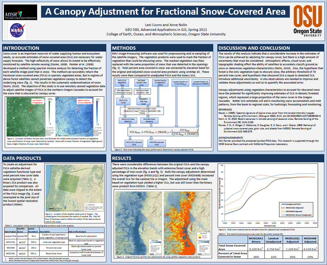
A Canopy Adjustment for Fractional Snow-Covered Area
By Lexi Coons and Anne Nolin
|
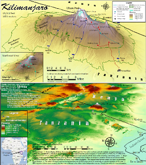 |
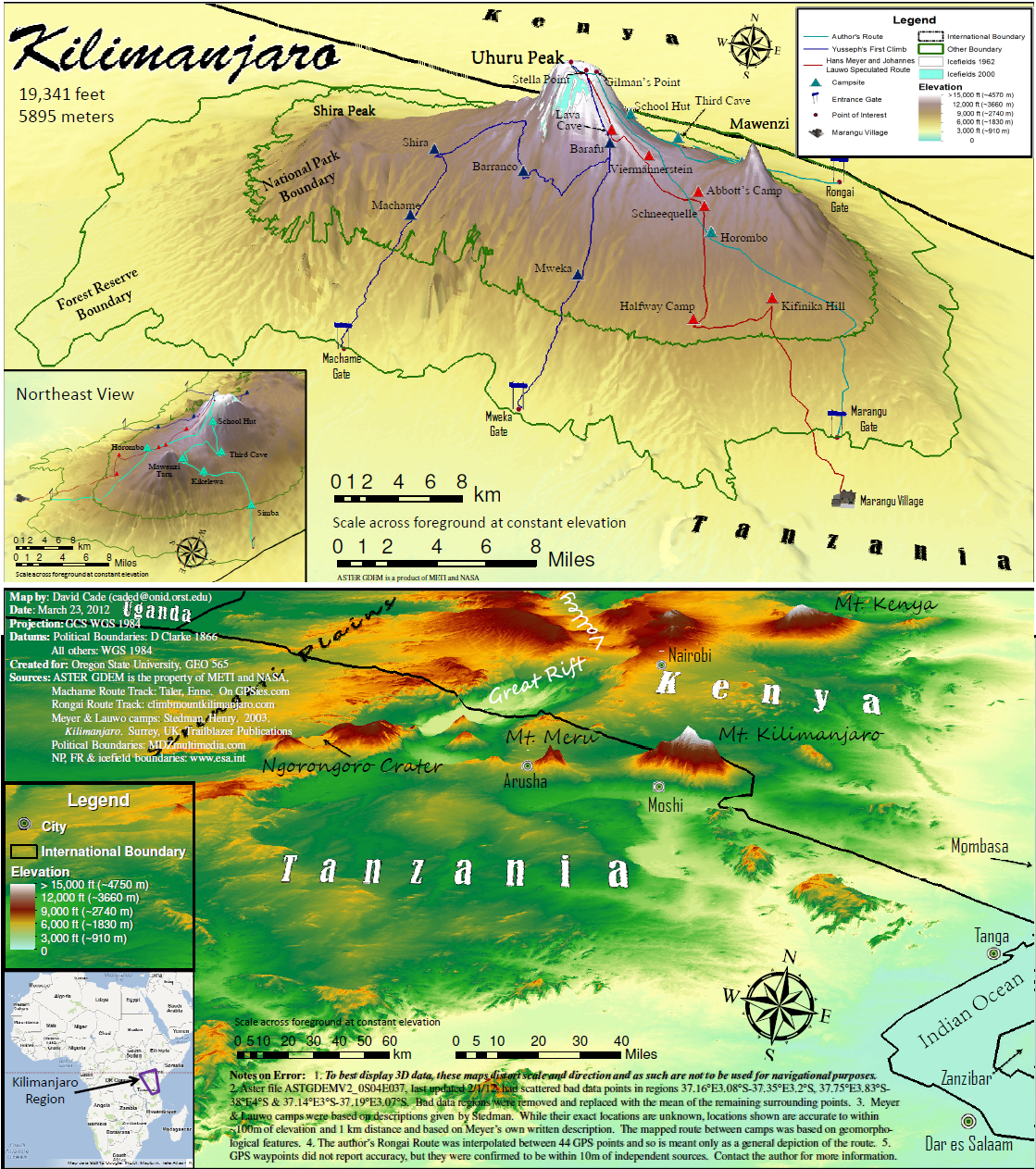
A Climbers Map to Kilimanjaro
By David Cade
|
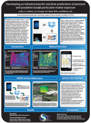 |
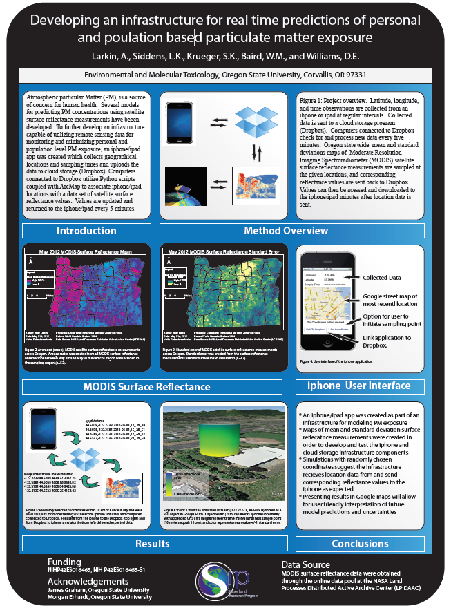
Developing an infrastructure for real time predictions of personal
and population based particulate matter exposure
By Larkin, A., Siddens, L.K., Krueger, S.K., Baird, W.M., and Williams, D.E. |
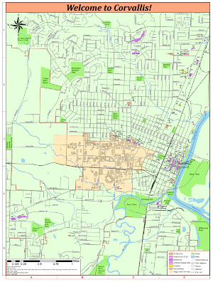 |
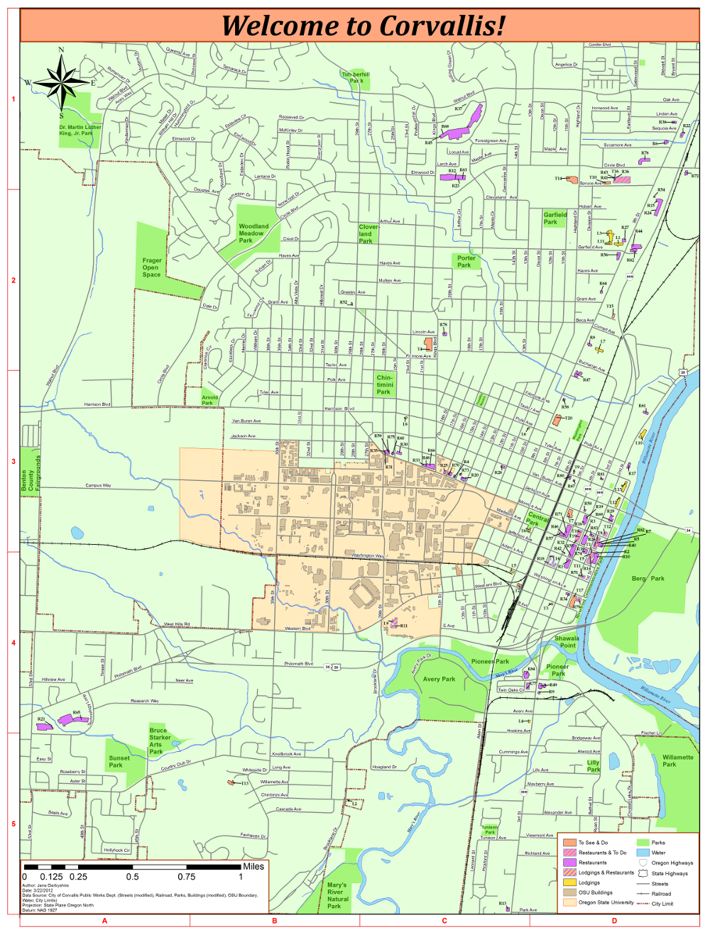
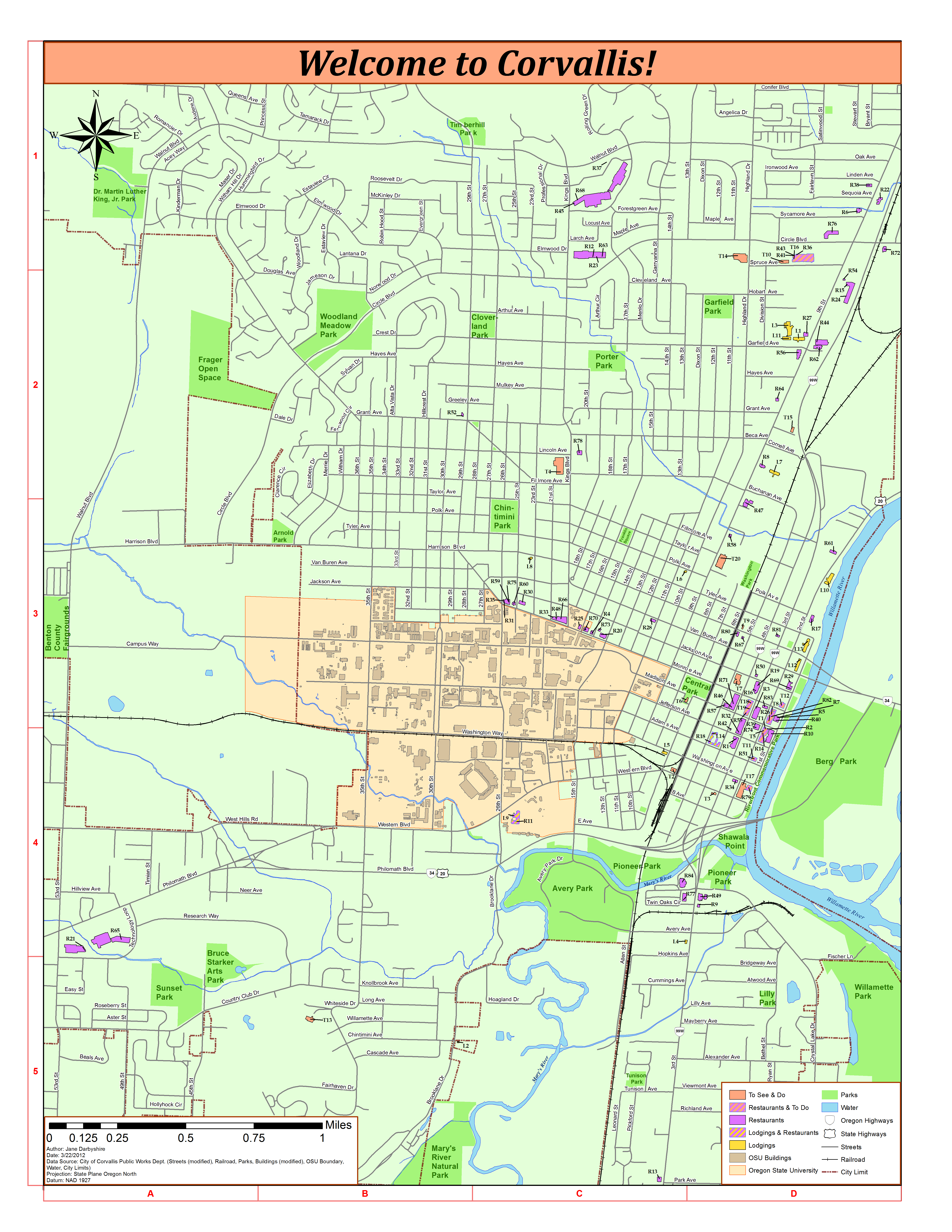
A Map of Corvallis Oregon
By Jane Darbyshire
This map shows how label placement can be improved by individually positioning labels in software like PowerPoint or Adobe Illustrator rather than using automatically placed labels. |
 |
How does social vulnerability to climate change spatially correspond to land cover in Ghana, West Africa?
By Sophia Polasky Lauer |
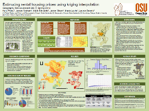 |
Estimating rental housing prices using Kriging interpolation
By Kelly Foley, James Graham, Mark Edwards, Jarrod Olson, Maria Lewis, Lauren Dennis |
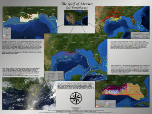 |
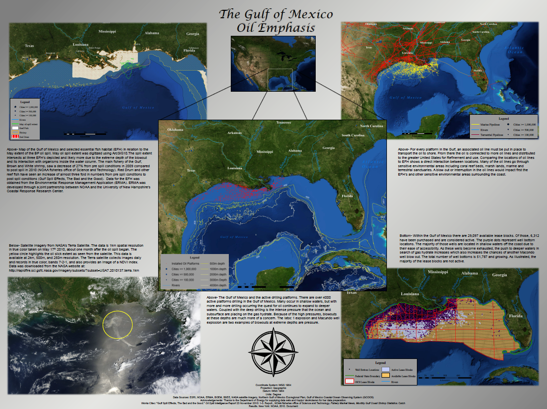
The Gulf of Mexico: Oil Emphasis
By Jake Nelson |
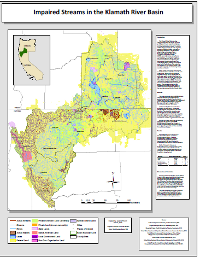 |
Impaired Streams in the Klamath River Basin
By Jessica Picucci |
