Image Acquisition
Unmanned aircraft systems can be equipped with a variety of sensors, enabling the acquisition of various data types. Imaging systems include RGB cameras, multi-spectral and thermal sensors, and Light Detection and Ranging (LiDAR) systems. Data acquired with these systems can be used to create orthophotographs, digital elevation models, 3D models, supervised and unsupervised classifications, and a variety of multispectral indices, such as the normalized difference vegetation index (NDVI) and the normalized burn ratio (NBR).
Today, much of the technical requirements for RGB and video data acquisition with UAS have been automated, resulting in user-friendly platforms that nearly anyone can operate. This functionality is even available on low-cost ($500) systems. However, low-cost solutions have limitations. Data quality is generally lower, and post-processing requirements can be significant. As the price of an UAS goes up, data quality increases, while data processing times can decrease. For researchers with small budgets, that require ultra-high-resolution RGB images or multispectral or thermal data, ready-to-fly (RTF) solutions can be too costly. Developing systems and methodologies capable of achieving data acquisition requirements is needed.
Student Projects
Automating RGB Image Acquisition and Post-Processing
Students at Humboldt State have been working to test and develop methods for gathering and processing data. Using the 3D Robotics Pixhawk flight controller, a Sony Alpha 5100, and the Simple Multi Shutter (developed by MobileXCopter), camera focus and shutter functions can be automated based on the distance an aircraft has flown. This process provides the precise image overlap required for effective post-processing.
|
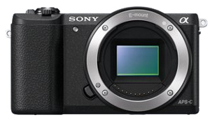
Figure 1. Sony Alpha 5100.
|
Geotagging and Georeferencing
Some cameras, like the Canon S100, have an internal GPS that can geotag images as they are captured. Most higher-end RGB cameras, such as the 24 megapixel Sony Alpha 5100, do not provide geotagging functionality. Geotagging can be achieved using software, such as Mission Planner, a UAS mission planning and programming solution. However, many GIS packages, ArcMap as an example, require georeferenced, rather than geotagged images. HSU students are using the Python programming language to develop programs to automate this process. Students have also developed various methods for establishing ground control points to improve data quality.
|
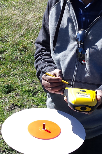
Figure 1. Sony Alpha 5100.
|
