Estimating Potential Salmonid Habitat and Carrying Capacity in the Upper Mainstem Eel River, California, USA
By Emily Cooper
Project Abstract:
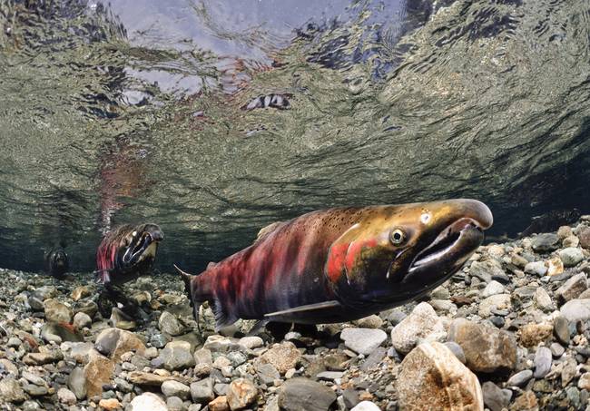
Anadromous salmonid populations in northern California’s Eel River watershed have been impacted by two dams that are part of the Potter Valley Project, and current populations of Coho Salmon (Oncorhynchus kisutch), Chinook Salmon (O. tshawytscha), steelhead trout (Oncorhynchus mykiss) are estimated between 1-3% of their historic populations. In response to the need for addressing the upcoming FERC relicensing of Scott Dam, this project provides an assessment of salmonid habitat and an estimation of potential stream carrying capacity for steelhead trout and Chinook Salmon in the Upper Mainstem Eel River watershed above the impassable Scott Dam. To determine potential distribution of each salmonid species, fish passage barriers upstream of Scott Dam were identified using the Intrinsic Potential (IP) Model from National Marine Fisheries Service and ground-based verification. Streams within the designated study area were stratified into reach types based on gradient and drainage area and were then subsampled for habitat assessment field surveys. A total of 20 wetted stream reaches totaling 13.2 stream km and 11 dry stream reaches totaling 6.3 stream km were surveyed during summer 2016. GIS and ground-based analyses determined 463 stream-km (288 mi) available for potential steelhead spawner distribution, of which up to 333 stream-km (207 mi) are available for potential steelhead rearing distribution. A total of 144 stream-km (89 mi) were determined available for potential Chinook spawning and rearing distribution. These estimates include stream habitat currently inundated by Scott Dam’s reservoir, Lake Pillsbury. Habitat survey data were summarized as they relate to species-specific densities to determine potential capacity for the respective capacity-limiting life stages of steelhead and Chinook. Two methods for modeling potential capacity for each species of interest were used. First, the Unit Characteristic Method provided reach-scale estimates using fish density values specific to habitat units (i.e. pools, riffles, glides), and the density values were then adjusted according to other habitat parameters (i.e. fish cover, depth, substrate, etc.) and how they deviate from average conditions within the study area. Habitat data characterization and capacity estimates respective to survey reaches were analyzed for variation across reach type categories while accounting for potential non-independence due to the clustering of sites into reaches. These results determined pooling of reach type strata for data extrapolation of capacity estimates from the reach to watershed scale for the entire study site. The second modeling method was an open-source, GIS-based capacity estimation model called Ripple, which estimates specific capacity for a given species for each life stage at simulated seasonal flow events using a 10m resolution digital elevation model. The results from these two approaches to estimating potential capacity were compared to each other and to estimates from past reports including the IP Model. This research has the potential to inform the relicensing of Scott Dam as well as recovery management for native anadromous salmonid populations in the Eel River.
Using the Map Below
Each survey site is associated with a route. Each route shows both driving and hiking directions. When you select a survey site the route will be highlighted and information on the site will be given in a popup window. This map also contains a "Campsites" layer with links to websites with more information on the campsite.
Disclosure
In no event will we be liable for any direct, indirect, consequential, incidental, special or exemplary damages for any use of this map. The areas around the Eel River are subject to poor weather conditions, wildfire, landslides, road closures, and the like at any time - users should use their best judgement while exploring the area.