A raster image is the same type of image that you have been taking with a digital camera or your phone.
Below is a digital photo of two turtles.
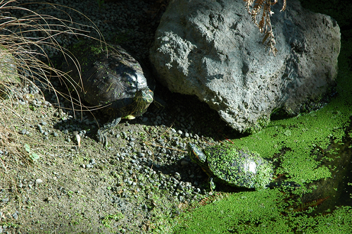
At first, the photo appears to be continuous.
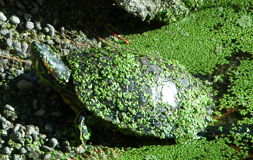
But, as we zoom in, we begin to see that the photo is made up of thousands (or millions) of individual "picture elements" or pixels.
![]()
Each of these pixels contains numbers that represent the amount (and color) of light that was captured by the camera and is now being emitted by the monitor.
![]()
This data can be continuous:
Or categorical:
What makes rasters unique from vector data is that rasters cover an area with a uniformly spaced grid of "pixels".
Uses grid cells of a given dimension to represent the value or attribute of a real world entity or phenomenon. This allows us to represent data that is uniform over the landscape. Below is an example with a raster that contains elevation values in each of the pixels.
![]()
In a raster layer, the cells are arranged in rows and columns.

All cells in a raster layer are typically the same size.
One of the key issues with rasters is there "resolution". The pixels within a raster are also referred to as "Cells" and so the resolution of a raster may also be referred to as "cell size".
Cell size = Spatial Resolution: the dimension of the area covered on the ground and represented by a single pixel (e.g., 10m).
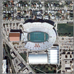
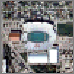
A LandSat image has a resolution of 30 meters which means each pixel is about 90 feet by 90 feet square. This means you can see large buildings, lakes, forest, and freeways in LandSat images but you would not be able to see a shack, a stream, a single tree, or a trail.
You might think we would always want to use the highest available resolution but the problem becomes the size and availability of the data.
You must balance your application's need for spatial resolution with practical requirements for quick display, processing time, and storage.
| 1 Meter Resolution | 10 Meter Resolution | 30 Meter Resolution |
 |
 |
 |
Raster Size
The greatest challenge with raster data is it's size. The problem is that as the resolution of the pixels increases (i.e. goes from 100 meters to 10 meters), the number of pixels in the rasters increases in both the horizontal and vertical directions. This means that as the resolution increases by a factor of 10, the number of pixels in the raster increases by a factor of 100!
There are hundreds of different raster file formats available. Which ones you use will determine if the file can maintain a spatial reference and if the software you are using can open the file.
The following file formats are the most common and are recommended for spatial data:
The following formats are also used for raster data in GIS because they can be spatially referenced. However, we recommend converting data in these formats to IMG or TIFF if you are going to use them as part of a long-term project.
The following formats are not really recommended for GIS data:
Note: Esri has indicated that they will not be supporting the "ESRI GRID" format in the future so it is not recommended.
© Copyright 2018 HSU - All rights reserved.