The process of converting features on a map or image into digital vector data is called digitizing. There are two basic methods of digitizing:
Scan digitizing works for some data sets but we'll be using manual digitizing as it always works.
Manual digitizing is human guided coordinate capture from a map or image source (tracing).
1. Heads-up Digitizing (on-screen)
2. Hardcopy Digitizing
If you need to digitize a large amount of information, you may want to use hardcopy digitizing as it can be more accurate but it requires a tablet to be efficient. We'll be doing "Heads-up Digitizing".
Map scale is the relationship between distance on the map and distance on the ground. Knowing the scale you are digitizing at is critical to maintaining accuracy of the data you are creating.
The scale of your map is not fixed in a GIS. It can be adjusted in ArcMap using the map scale drop down tool:
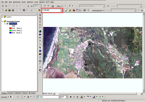
A larger scale of the same map:
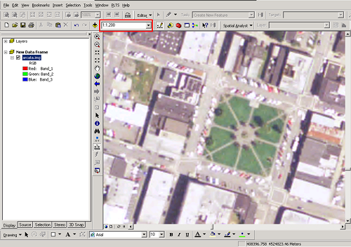
Note: Many people confuse the terms "small" and "large" scale. Remember that features appear "small" on a "small scale" map and appear "large" on a "large scale" map.
Positional errors are inevitable when data are manually digitized. Examles include undershooting, when your coordintes do not connect as they should, and overshooting, when the lines go past where they shood. Often these errors are not visible unless you zoom in quite a bit on the coordinates.
Below is an example with the "true" spatial layout of some parcels on the top and our result of digitizing on the bottom. In reality, you would probably never see the issues at this scale, we have exagerated them.

Setting a fuzzy tolerance (snapping tolerance) is used to reduce undershoots and overshoots. The snapping tolerance is the minimum tolerated distance between nodes, lines and/or vertices. When snapping is turned on, your cursor will jump to an existing point if it is within the snapping tolerance. Then, the coordinates at the same point will have exactly the same values.
The most important factor for success is to find out what the requirements are for the final data and make sure you have data that contains all the information you need at a high enough resolution. A great example is digitizing the HSU sports complex. If someone just wants the main buildings to be roughly identified, then a low resolution image with a few polygons is fine. However, if they want all the small buildings, signs, fields, fences, and bleachers to be included, then you need a high resolution image and it will take you much longer to do the digitizing. What you will need to then determine for each type of feature is do you:
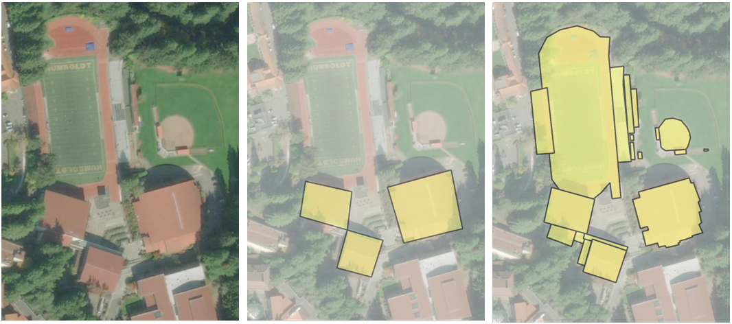
HSU Sports Complex
© Copyright 2018 HSU - All rights reserved.