Commercial Satellites
In addition to the many earth observing satellites managed by governments, there are also many commercial earth observing satellites. This has increased in recent years as there is increasing demand for up-to-date, high resolution satellite imagery. This imagery is used by mapping companies (Google Maps etc.), by private companies and researchers. There is a large amount of commercial satellite data available, but unlike Landsat data there is a significant cost associated with purchasing the data.
SPOT
SPOT or Satellite Pour l’Observation de la Terre (French for "Earth observation satellite") is a commercial high-resolution earth observing satellite. The first SPOT satellite was launched in 1986 with 10 m panchromatic and 20 m multispectral spatial resolution. Several generations of SPOT satellites have been launched in the past decades. SPOT 5-7 are still active and have spatial resolutions ranging from approximately 2-10 meters.
IKONOS
IKONOS was launched in 1999 by GeoEye and was the first satellite to collect publicly available high-resolution imagery at 1 and 4-meter spatial resolution. The four bands included Blue, Red, Green, and NIR wavelengths. GeoEye and DigitalGlobe merged in 2013.
DigitalGlobe Imagery
DigitalGlobe is one of the largest commercial providers of satellite imagery. A significant amount of Google Earth and Google Maps high resolution-imagery is provided by DigitalGlobe. DigitalGlobe has launched and acquired several earth observing satellites in the past 15 years. Over the past year DigitalGlobe
- Quickbird – Launched in 2001
- 0.60 m, panchromatic
- 2.4 m multispectral resolution
- WorldView-1 – Launched in 2007
- 0.50 m panchromatic resolution
- WorldView-2 – Launched in 2009
- 0.46 m, panchromatic
- 1.84 m, 8 band multispectral
- WorldView-3 & 4– Launched in 2014, 2016
- 0.3 m, panchromatic,
- 1.24 m, 8 band multispectral
- 3.7 m Shortwave Infrared
WorldView-3 and WorldView-4 have some of the best spatial and spectral resolution data that is available to the public. WorldView-3 & 4 provide 31 cm panchromatic resolution, 1.24 m multispectral resolution, 3.7 m short wave infrared resolution. WorldView-3 has an average revisit time of less than 1 day and is capable of collecting up to 680,000 km2 per day.
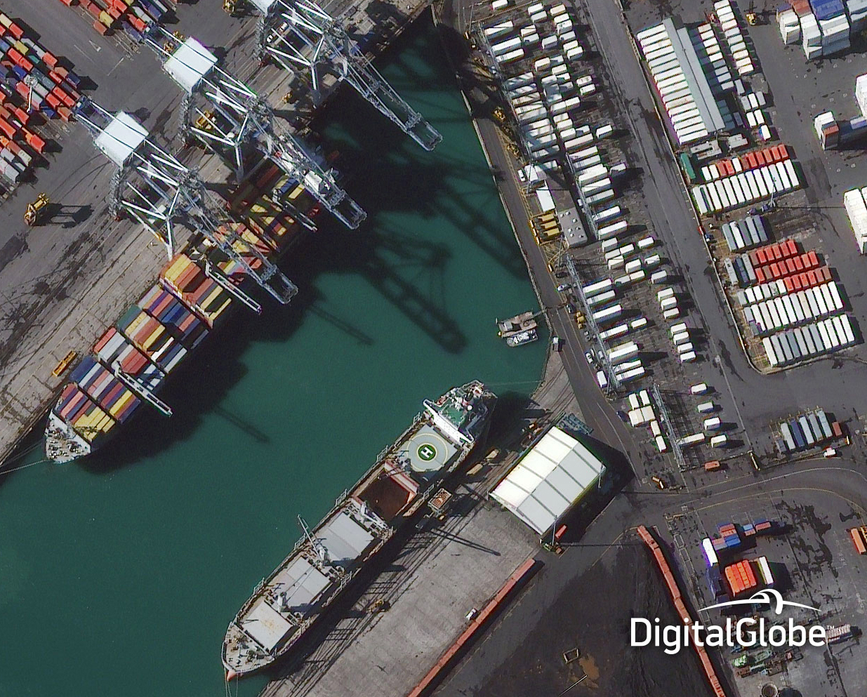 WorldView-3 Satellite Image
 Image Credit: Digital Globe
Micro Satellites
Micro satellites are significantly smaller than traditional earth observing satellites. This reduces the weight and cost and makes it easier to launch multiple satellites. Many of these satellites are launched in groups or "constellations". These satellites are usually in Low Earth Orbit (LEO) and because of their orbit and numbers have a high return rate (temporal resolution). Commercial applications of the imagery include mapping, real estate and construction, and oil and gas monitoring.
Planet : Dove Satellites
Planet (formerly Planet Labs) has been launching it's small satellites known as "Doves" over the past couple of years. These satellites weight approximately 5kg each and have a spatial resolution of 3-5 meters. FLOCK 1 was the world’s largest constellation of Earth-imaging satellites, and is comprised of 28 Dove satellites. There have been 14 successful Dove launches and deployment to date and well over 100 small satellites in orbit.
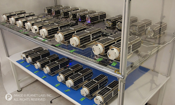
FLOCK 1 Dove Satellites
Image Credit: Planet Labs
Explore: Planet Explorer Beta
Planet labs has released some of its imagery for free through their Education and Research program. If you are a student, researcher or educator additional imagery may be available. Apply to the Education and Research Program to request access to datasets. The majority of the data available is 3-5m spatial resolution and four band (visible and NIR).