Geospatial Data Models
A data model is a way of defining and representing real world surfaces and characteristics in GIS. There are two primary types of spatial data models: Vector and Raster.
- Vector data represents features as discrete points, lines, and polygons
- Raster data represents features as a rectangular matrix of square cells (pixels)
Vector Data Model
Vector data is very common, and is often used to represent features like roads and boundaries. Vector data comes in the form of points and lines that are geometrically and mathematically associated.
Types of Vector Data
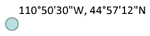
- Points:
- One pair of coordinates defines the location of a point feature.
- Individual X,Y
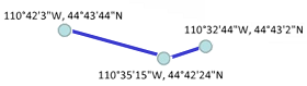
- Polylines (LineStrings):
- Two or more pairs of coordinates that are connected define a line feature.
- A series of connected points - Actually, a set of series of connected points.
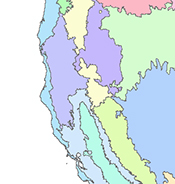
- Polygons:
- Multiple pairs of coordinates that are connected and closed define a polygon feature.
- A series of connected points that loop back to the first point
- Multiple "polygons" can exist in one layer
- Polygons can have internal polygons or "holes"
- The beginning and ending coordinates for a polygon are the same.
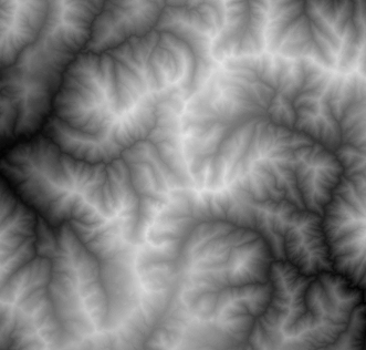
Raster Data Model
Raster data models represents surfaces as a matrix of cells, more commonly known as pixels, that are organized into rows and columns. Each cell contains a value that represents data. When you use a digital camera to capture a photo, your image is being stored as raster data. In remote sensing, a majority of the data encountered is raster data. The below image is a Digital Elevation Model (DEM) which is a common type of raster data. Each pixel represents the elevation of the area on the ground. Raster data models can be used to store reflectance data, elevation data and categorical data like soil or land cover type.