Learning Module 11.1
Image Classification
Introduction
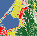
In this module, we will cover image classification techniques. Image Classification is the process of grouping areas of an image into a number of classes or categories that represent similar features. The process produces "thematic maps" based on the original image or data. Unlike image interpretation, which is carried out by a human, the majority of these classification techniques are carried out by a computer. Image classification is used in many regional-scale projects and is often done to generate land cover data sets.
Learning Outcomes
- Understand the difference between pixel based and object classification methods.
- Learn how to conduct supervised and unsupervised classification procedures in ENVI.
- Evaluate different classification methods and select appropriate methods.
- Analyze classification results, including labeling, color coding classes and calculating the area of classes.
Readings
- Read pages 281-299 in Principles of remote sensing: An introductory textbook
Presentations and Content
- Classification Overview
- Unsupervised Classification
- Supervised Classification
- Object-Based Classification
- Land Use/Land Cover Data