ArcGIS Spatial Analyst Tools
Introduction
Raster analysis can often be improved by including additional data or layers. In the previous examples we used Digital Elevation Models (DEMs) in our raster analysis. From DEMs, we can derive other types of terrain rasters including:
- Slope
- Aspect
- Hillshades
- Contours
Slope
Slope is the measure of steepness or the degree of inclination of a feature. Slope is typically expressed as a percentage or as an angle.
Percent Slope = Change in elevation / Distance. This is also known as "rise over run". Degrees = angle of the slope from a line that is parallel with the earth.
Slope rasters can be computed from DEMs. Typically, slope is computed using a 3 x 3 matrix of pixels around the target pixel. A plane is fit through these pixels and then the maximum slope of the plane is used as the slope value. Slope is commonly used in raster analysis.

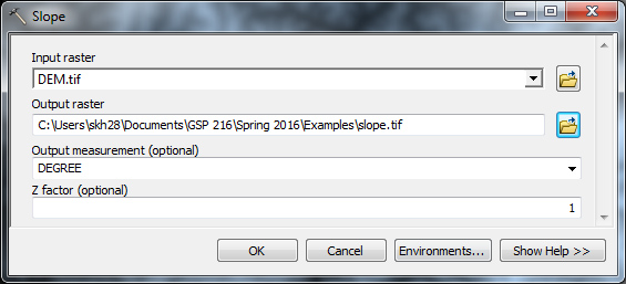
Interactive Slope Tool
Aspect
The aspect of terrain refers to the direction it’s facing and is computed in degrees from due north. Aspect relates to amount of sun exposure, in the northern hemisphere a north-facing slope faces away from the sun and therefore is generally cooler and wetter than a south-facing slope. The aspect of a slope can make very significant influences on its micro-climate and vegetation. Given this influence on vegetation, aspect is frequently used in raster analysis. Aspect is always given as a direction in degrees, for example a North facing slope the aspect would be between 0-22.5 degrees.
Aspect is computed in a similar way to slope in that a plane is fit through a 3x3 grid of pixels. However it's the direction of the plane that is used for the pixel value instead of the slope.
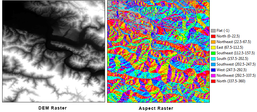

Contours and Hillshades
Contours and hillshades are useful when displaying data but are rarely used for analysis purposes.
Contours
Contour lines, also called isolines, connect points of the same elevation. Contour lines are useful because they allow us to visualize the topography of a landscape on a map. The contour interval of a contour map is the difference in elevation between successive contour lines. The closer together contour lines are the steeper the terrain.

Hillshade
Hillshades are common background used in maps. A hillshade is a 3D representation of a surface using the sun's relative position to provide shading and depth to the image. A hillshade is a raster that essentially appears to be a photo from above the sea, shaded by the sun. Hillshades can be created quickly with a DEM and inputing the azimuth and altitude of the sun.
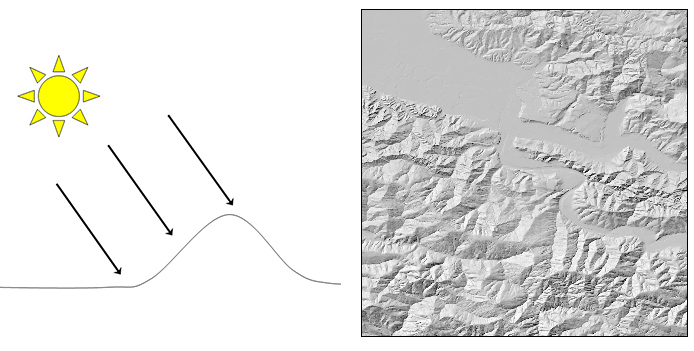
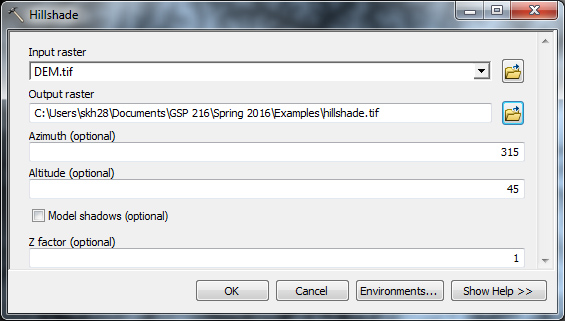 You can create your own backgrounds in ArcMap by simply:
- Load a DEM into ArcMap
- Stylize the DEM with an appropriate color ramp
- Make the DEM 50% transparent
- Create a "hillshade" of the DEM
- Move the DEM so it is "on top" of the hillshade layer
