Processing
Subset/Clip
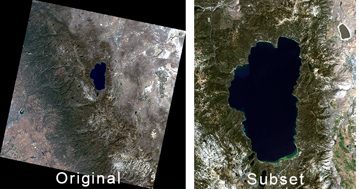
Many rasters cover large areas, for example one Landsat 8 scene covers 185 km by 180 km. The raster file sizes can be very large (~1 GB for Landsat 8) and processing can be time consuming. Often the actual area of interest is much smaller. Therefore it makes sense to create a subset of your image that only includes the areas you are interested in. This saves disk space and processing time. Some software packages refer to this process as subsetting while others use the term clipping. Most raster data can be subset using XY coordinates, vector files or user created Regions of Interest (ROI). This process always creates a new dataset that only contains your data subset.

The original image (left) file size is approximately 820 MB, while the subset (right) is only 44 MB
Mosaicking
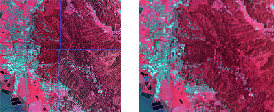
Mosaicking is the process of creating a mosaic or combining multiple images of an area to produce one, seamless raster file. Many raster files like NAIP images cover relatively small areas and multiple files may be needed to cover your area of interest. ArcGIS and ENVI include mosaic tools that allow you to merge multiple datasets into one raster. The mosaic tools also include techniques to balance contrast and color between multiple images. These mosaic techniques can help minimize the abrupt changes along the boundaries of the overlapping rasters.

